
Skip to product information
1 of 30

🟢authorized PARTNER

SKU:FJTX1

FJD Trion X1 SLAM LiDAR Scanner with Guided Reality Capture FJTX1

FJD Trion X1 SLAM LiDAR Scanner with Guided Reality Capture FJTX1

Regular price $12,999.00 USD
Regular price Sale price $12,999.00 USD
Sale Sold out
Shipping calculated at checkout.

✅Includes Warranty

✅30-Day Returns

✅Unlimited Free Support

The FJD Trion X1 is a handheld SLAM LiDAR scanner built for teams that need consistent, traceable reality capture across multiple sites, operators, or field assignments. Instead of sending an operator onsite with separate instructions, project requirements can be prepared in FJD Trion Model Web and delivered directly to the scanner.

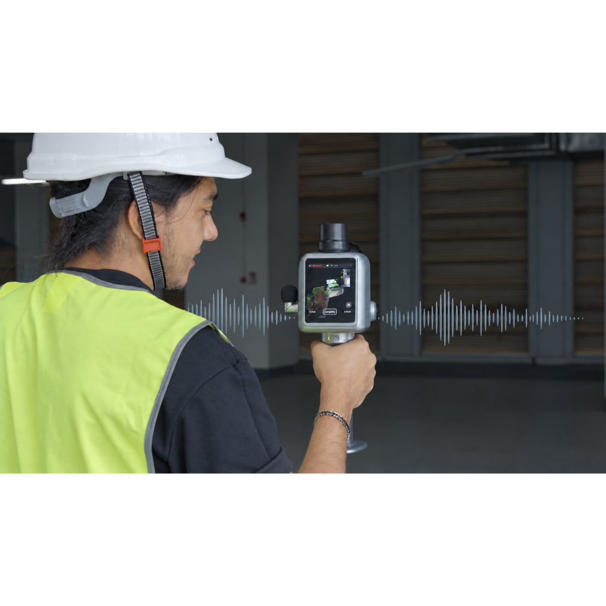
During capture, the operator follows onscreen guidance, monitors the scan through the integrated display, marks issues within the 3D record, and adds voice observations. The resulting point cloud, imagery, route information, issue markers, and field notes can then be processed and reviewed within the FJD Trion software environment.

The X1 combines LiDAR, Visual SLAM, GNSS support, panoramic imaging, and a 3.9-inch OLED display in a 1.3 kg full configuration. It is particularly relevant to construction documentation, incident records, outdoor asset capture, and other workflows where collecting the correct information consistently matters as much as collecting the point cloud.

Best fit for:

  • Construction, BIM, VDC, inspection, and asset teams coordinating field capture across several operators or locations.

  • Organizations that need issue locations and field observations connected to the spatial record.

  • Projects requiring E57, LAS, PLY, or PTS point-cloud deliverables.

  • Indoor and outdoor assignments where handheld mobility and guided execution are priorities.

Consider another configuration when:

  • The primary requirement is long-range capture rather than guided field documentation.

  • The project requires tripod-based terrestrial scanning.

  • Survey control or a defined RTK accuracy specification is mandatory.

  • The workflow does not require issue tracking, voice observations, or standardized capture assignments.

Not sure whether the X1 fits your accuracy, positioning, and deliverable requirements? Send Precision 3D Works your workflow requirements.

Key Features

Guided field assignments
Define the capture area, route, and priorities in FJD Trion Model Web, then send the task to the X1. Onscreen guidance helps operators follow the intended procedure without relying on separate written instructions or a phone.

Issue marking within the 3D record
Use the onscreen crosshair to mark a visible condition while scanning. The issue remains connected to its location in the captured spatial record, giving office teams more context than a disconnected photograph or written note.

Voice-supported field observations
Operators can record voice notes during capture while the onsite context is still available. Those observations can be transcribed and reviewed through Model Web.

Integrated LiDAR and panoramic imaging
The X1 records up to 384,000 points per second and incorporates two 48 MP panoramic cameras, providing measurable geometry alongside visual site context.

Built-in field display
The 3.9-inch OLED display lets the operator see where the scanner is aiming and monitor the capture directly on the device, keeping phone calls and notifications outside the primary scanning workflow.

Visual SLAM and GNSS support
Visual SLAM supports continuous handheld capture through indoor and mixed environments. Integrated GNSS supports applicable outdoor georeferencing workflows where satellite visibility permits.

Field-oriented configuration
The full setup weighs 1.3 kg and provides up to five hours of stated operation with one set of two batteries. An IP54 rating and published −20°C to 50°C operating range support varied field assignments.

Applications

Construction Progress and As-Built Documentation

Typical users: BIM/VDC teams, contractors, renovation specialists, and reality-capture providers.

Workflow: Define the assignment in Model Web → capture structural, architectural, or MEP conditions → mark discrepancies onsite → process and review the point cloud → export to a compatible CAD, BIM, or point-cloud environment → create an as-built record or modeling reference.

Why the X1 fits: Guided assignments help standardize how different operators document buildings and construction stages. Issue markers and voice notes preserve field context, while E57 and other point-cloud outputs support downstream coordination and modeling. The exported point cloud is a source dataset rather than an automatically completed BIM model.

Forensic, Incident, and Safety-Scene Documentation

Typical users: Investigators, safety personnel, engineering consultants, and incident-response teams.

Workflow: Establish the capture scope → record the scene in 3D → mark relevant locations → add voice observations → review the combined scan and imagery → generate a spatial record or project report.

Why the X1 fits: The scanner brings geometry, panoramic imagery, issue locations, and field observations into one traceable workflow. Organizations working in regulated or evidentiary environments remain responsible for their own chain-of-custody and documentation procedures.

Urban Trees and Distributed Outdoor Assets

Typical users: Arborists, campus facilities teams, landscape managers, and municipal asset personnel.

Workflow: Assign the target area → follow the planned route → capture trees, paths, roads, or surrounding assets → process and organize the dataset → export to a compatible GIS, point-cloud, or asset-management workflow → create an inventory or condition record.

Why the X1 fits: Its handheld form supports assets distributed across campuses, parks, roads, and green belts. GNSS-assisted positioning supports outdoor records, while the guided assignment helps teams collect comparable information across different operators and locations.

Material Yards and Stockpiles

Typical users: Quarry personnel, site managers, material operations, and measurement contractors.

Workflow: Plan the coverage route → capture the material surface → process the point cloud → calculate volume in compatible analysis software → produce a volume record or operational report.

Why the X1 fits: Continuous handheld capture helps document material surfaces without setting up multiple fixed scan stations. Final volume quality depends on surface visibility, capture coverage, positioning, processing, and the reference surface used for the calculation.

LiDAR Performance and Data Workflow

The X1 records up to 384,000 points per second across a 360° × 62° LiDAR field of view. Its published range is 40 m at 10% reflectivity and 70 m at 80% reflectivity, so darker or less reflective surfaces will generally produce a shorter usable range than brighter targets.

FJD Trion publishes post-processed point-cloud accuracy of ±1 cm relative and ±3 cm absolute under laboratory testing. These figures should be evaluated separately from GNSS performance: relative accuracy describes consistency within the captured dataset, while absolute accuracy concerns its position relative to the project coordinate framework.

The connected workflow consists of four stages:

  1. Plan: Define the area, route, and capture priorities in FJD Trion Model Web.

  2. Capture: Send the assignment to the X1 and follow its onscreen guidance.

  3. Document: Mark issues and add observations while their field context is available.

  4. Process and review: Bring scans, route data, issue markers, and observations together for processing, collaboration, and reporting.

FJD Trion Model Web supports browser-based task preparation, project coordination, online processing, collaboration, and reporting. FJD Trion Model provides detailed point-cloud editing and analysis on compatible computers and tablets.

Data can be transferred by wireless network, USB Type-C, or USB flash drive. Supported point-cloud formats include E57, LAS, PLY, and PTS, while images can be exported as JPG files.

Included in the Purchase

Included Component Description
FJD Trion X1 scanner system Factory-assembled handheld scanner integrating LiDAR, cameras, display, positioning, storage, and processing hardware

The final Precision 3D Works quotation will itemize the supplied battery and charging equipment, carrying equipment, software access, and any selected accessories.

Technical Specifications

Category Specification Published Value
LiDAR Point rate 384,000 points per second
LiDAR Scanning range 40 m at 10% reflectivity; 70 m at 80% reflectivity
LiDAR Post-processed point-cloud accuracy Relative: ±1 cm; absolute: ±3 cm
LiDAR Field of view 360° × 62°
LiDAR Laser safety Class 1 eye-safe laser
LiDAR Scan resumption Supported
Imaging Panoramic cameras Two 48 MP cameras
Imaging Panoramic field of view 360° × 360°
Imaging Front-camera resolution 1280 × 1024
Imaging Front-camera field of view 80° × 44°
Imaging Visual SLAM Supported
Imaging Image export JPG
Display Screen 3.9-inch OLED
Display Resolution 1280 × 1024
Power Battery life Up to 5 hours with one set of two batteries
Power Power supply DC handheld battery
Power Power consumption Approximately 18 W
Power Charging 67 W fast charging
Power Simultaneous dual-battery charging Supported
Physical Dimensions 114 × 152 × 329 mm
Physical Main-unit weight 900 g
Physical Full-setup weight 1.3 kg
Storage Internal capacity 512 GB; expandable to 1 TB
Environment Operating temperature −20°C to 50°C
Environment Storage temperature −40°C to 60°C
Environment Ingress protection IP54
Connectivity Data transfer Wireless network, USB Type-C, USB flash drive
Output Point-cloud formats E57, LAS, PLY, PTS
Positioning GNSS Integrated GNSS support

Published accuracy was established under laboratory testing. Field results vary with the environment, capture method, SLAM conditions, positioning, control, and processing workflow.

Optional Accessories and Configuration

  • Compatible external microphone for voice-supported field observations

  • Storage expansion up to the published 1 TB capacity

  • FJD Trion Model and Model Web licensing appropriate to the required workflow

  • Additional field power, charging, and transport equipment when specified in the selected package

Optional and included equipment should be distinguished clearly on the final quotation.

Buyer FAQ

What makes the FJD Trion X1 different from a conventional handheld SLAM LiDAR scanner?
The X1 connects capture planning, guided field execution, issue marking, voice observations, processing, and reporting within one workflow. Its main differentiator is not simply point collection; it is helping organizations obtain more consistent field records across different sites and operators.

What accuracy does the FJD Trion X1 provide?
FJD Trion publishes post-processing accuracy of ±1 cm relative and ±3 cm absolute under laboratory testing. Actual project results depend on site geometry, operator technique, SLAM conditions, GNSS availability, control, and processing choices.

Is the FJD Trion X1 suitable for Scan-to-BIM?
Yes, the X1 can provide E57 and other point-cloud outputs for compatible Scan-to-BIM workflows. Registration, cleanup, coordinate control, and BIM modeling remain downstream steps; the scanner does not automatically convert every capture into a finished Revit or CAD model.

Can the X1 be used indoors and outdoors?
Yes. Visual SLAM supports indoor and mixed-environment capture, while integrated GNSS supports applicable outdoor georeferencing workflows. Satellite positioning can become less reliable near buildings, beneath dense vegetation, or in other obstructed environments.

Which point-cloud formats can the X1 export?
The published formats are E57, LAS, PLY, and PTS. The required coordinate-system, imagery, and metadata behavior should be checked against the intended CAD, BIM, GIS, or point-cloud application.

What software is used with the X1?
FJD Trion Model Web supports task preparation, guided-project coordination, collaboration, and reporting. FJD Trion Model provides detailed point-cloud processing and analysis. The software edition, license term, seats, and cloud allowance should be itemized on the quotation.

What is included with the FJD Trion X1?
The purchase includes the factory-assembled X1 scanner system. Battery and charging equipment, carrying equipment, software access, and selected accessories will be listed individually on the Precision 3D Works quotation.

When should I consider another FJD Trion scanner?
Consider another configuration when longer range, tripod-based terrestrial scanning, or a published high-precision RTK workflow matters more than guided handheld documentation. Precision 3D Works can compare the X1 with the T1, P2, and S2 configurations against the required accuracy, site conditions, and deliverables.

📄 Product Brochure

View the official FJD Trion X1 Product Brochure.

📄 Customer Reviews and Feedback

Verified customer feedback can be presented through the Precision 3D Works product-review system as it becomes available.

📄 Owner's Manual

For the latest approved operating documentation, request the FJD Trion X1 manual from Precision 3D Works.

📄 Standard Warranty

The applicable warranty term, regional coverage, exclusions, and service procedure will be stated on the Precision 3D Works quotation. Request the current US warranty terms.

📄 View FJDynamics Trion Standard 1 Year Warranty

Need help confirming the scanner, software, and positioning configuration for your project?

Request a Quote | Talk to an Expert | +1 (213) 698-8700

View full details